
Artificial intelligence is becoming an increasingly useful tool in environmental science. Researchers can use machine learning, computer vision and other AI methods to analyze satellite images, sensor measurements, weather observations, wildlife recordings and other environmental datasets.
These systems can help classify observations, detect unusual patterns, estimate environmental conditions, generate forecasts and support decisions. But AI is not an environmental solution by itself. Its usefulness depends on the quality and representativeness of the data, the scientific validity of the model, how uncertainty is measured, and whether its outputs are interpreted correctly by researchers and decision-makers.
AI also has an environmental footprint of its own through computing infrastructure, electricity use, water consumption and hardware production. This guide explains what AI actually does in environmental science, where it is being used today, and where its limitations matter.
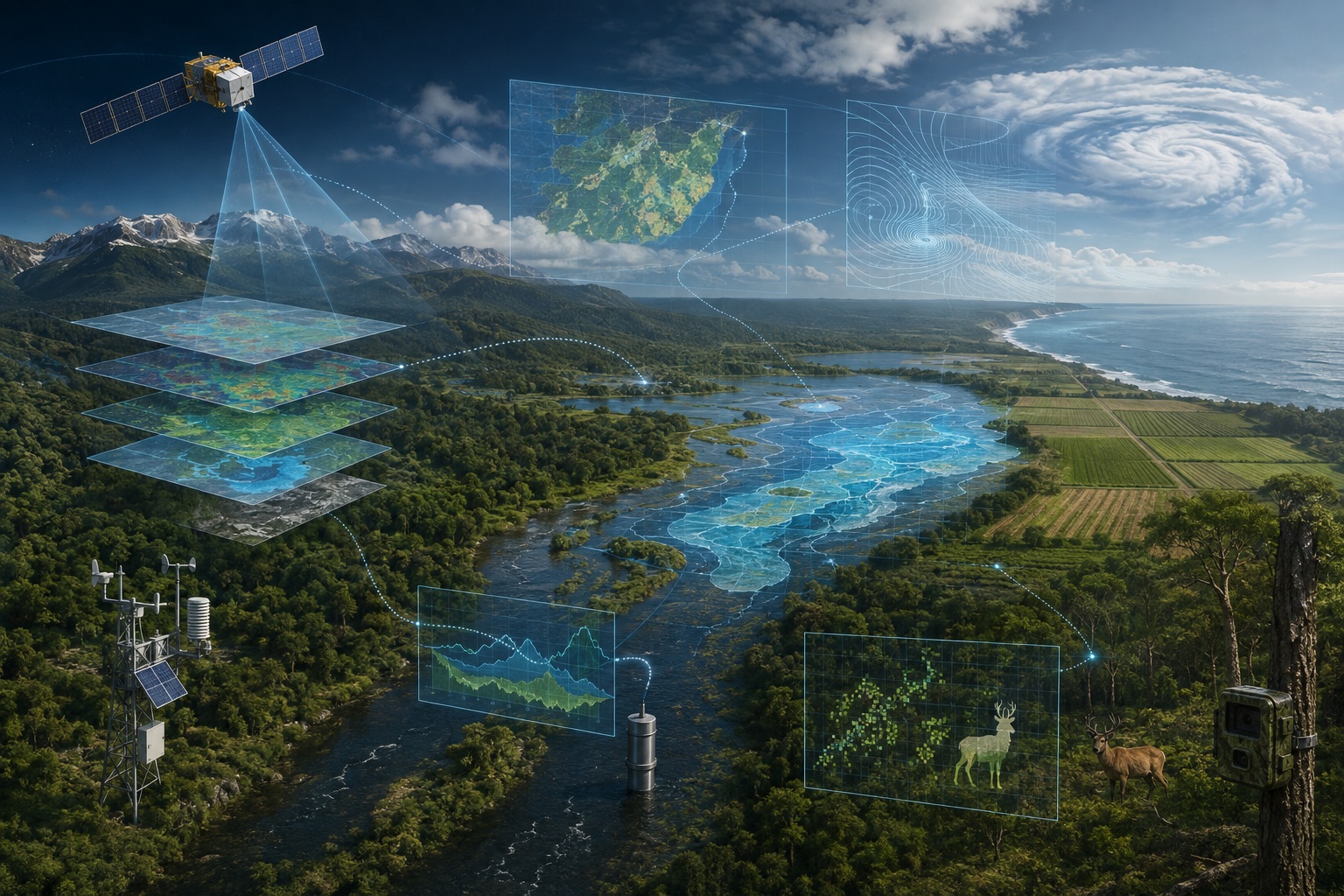
What Does AI Mean in Environmental Science?
AI in environmental science means using computational systems to perform tasks that help researchers analyze or act on environmental information. Most current applications use machine learning: models learn statistical relationships from existing data and then use those relationships to classify, estimate or forecast something new.
- identifying land-cover types in satellite images;
- classifying animals in camera-trap photographs;
- estimating environmental variables from sensor measurements;
- finding unusual pollution readings;
- forecasting weather conditions;
- mapping floods, fires or habitat changes;
- optimizing a defined resource-management problem.
The important distinction is that AI produces an output from available data—it does not automatically determine what that output means scientifically or what decision should follow. Researchers still need environmental knowledge, careful validation and appropriate uncertainty estimates. For a broader introduction to the technology, see Artificial Intelligence Explained.
Where Does Environmental AI Get Its Data?
Environmental science generates enormous quantities of observations. AI methods can be useful partly because they can process datasets that would be difficult to examine manually at the same scale.
Satellites and Earth Observation
Satellites repeatedly measure and image large portions of Earth. Their data can help researchers study land-cover change, vegetation, wildfires, flooding, surface temperatures, oceans, ice, atmospheric conditions and urban development. Computer vision and machine-learning models can help transform these observations into maps, classifications and estimates.
Ground, Weather and Ocean Sensors
Ground sensors can measure variables such as temperature, rainfall, air pollutants, soil moisture, river levels, water quality, wind and humidity. Weather stations, radar, satellites, ocean buoys and other observing systems provide data for atmospheric and ocean science. Models can analyze these measurements for trends, anomalies or forecasts.
Camera Traps, Acoustic Sensors and Field Data
Conservation projects collect photographs, video and audio from ecosystems. Computer vision may help classify animals appearing in images, while audio models can identify particular calls or acoustic patterns. AI can also be applied to ecological surveys, genomic information, laboratory measurements and other research datasets.
A realistic workflow is: environmental observation → data preparation → AI or statistical model → validated output → scientific interpretation → possible decision.
- ObserveSatellites, sensors and fieldwork
- Prepare dataQuality checks, labels and context
- ModelAI, statistics or physical methods
- ValidateTest outputs and quantify uncertainty
- InterpretScientists assess meaning and limits
- DecidePeople weigh evidence and trade-offs
What Can AI Actually Do With Environmental Data?
Classification and Estimation
A classification model assigns an observation to a category, such as a species, a land-cover type or an environmental event. Estimation models infer a quantity from available measurements—for example, estimating a variable where direct observations are sparse. Both tasks require testing against appropriate reference data.
Forecasting and Anomaly Detection
Forecasting models use past and current information to estimate future conditions. Anomaly-detection systems flag measurements or patterns that differ substantially from what is normally observed. A flag is a prompt for investigation, not proof that a harmful event has occurred.
Computer Vision and Optimization
Computer vision analyzes images from satellites, aircraft, drones and cameras. Optimization systems search for actions that perform well according to a defined objective, such as reducing energy use or improving a resource-management process. Optimization does not automatically produce an environmentally optimal decision: the result depends on the objective, constraints and trade-offs supplied by people.
Earth Observation and GeoAI
One of the strongest connections between AI and environmental science is GeoAI—the application of AI and machine learning to geospatial information. Earth-observation systems collect enormous quantities of data across space and time. Models can help turn those observations into maps and environmental indicators.
- mapping flood extent;
- identifying wildfire burn scars;
- classifying land use and land cover;
- tracking vegetation changes;
- studying urban development;
- analyzing changes in coastlines and ecosystems.
NASA describes GeoAI as an ecosystem that includes machine learning and Earth-observation foundation models. NASA and its partners have also developed the Prithvi geospatial foundation model for tasks including flood mapping, burn-scar detection and land-cover classification. These tools can make large datasets easier to analyze, but their outputs still require validation against appropriate observations and scientific knowledge.
AI in Weather Forecasting
Weather forecasting and climate modeling are related, but they are not the same problem. Weather forecasting estimates atmospheric conditions over relatively short periods. Climate modeling and projection investigate longer-term behavior, variability and possible future climate conditions under particular assumptions or scenarios.
AI is now part of operational weather forecasting. NOAA introduced operational AI-driven global weather prediction models, including AI-only and hybrid ensemble systems. Its initial AIGFS version improved tropical-cyclone track guidance but had weaker intensity forecasts. NOAA’s July 27, 2026 AIGFS v1.1 update reported improvements to tropical-cyclone intensity and precipitation forecasts, as well as reduced blurring at longer lead times. These improvements do not imply equal skill for every variable, event or forecast horizon.
AI does not simply replace atmospheric physics. Current approaches include fully data-driven forecast models, AI components within conventional systems, hybrid AI and physics-based models, and machine learning for data assimilation or post-processing. Performance must be evaluated by variable, location, event and forecast horizon.
AI in Climate Science
Machine learning can support climate research by analyzing large datasets, identifying patterns across simulations and observations, developing faster approximations of computationally expensive model components, studying impacts using satellite records and improving selected parts of Earth-system models.
These uses should not be reduced to the claim that AI “predicts climate change more accurately.” Climate projections depend on physical models, observations, future forcing assumptions, model uncertainty and many other scientific considerations. AI can be another tool within that process.
AI in Wildlife and Biodiversity Conservation
Computer-vision models can classify animals in camera-trap photographs, and audio models can identify calls or acoustic patterns in long recordings. Satellite and aerial imagery can support habitat-loss, deforestation and ecosystem-disturbance monitoring. Machine learning can also assist with patterns in genomic data and genetic diversity.
Identifying an animal in a photograph is not the same as producing a scientifically reliable population estimate. Population analysis may also depend on camera placement, sampling design, detection probability, repeated observations and ecological assumptions. AI can assist one part of the workflow without replacing the rest.
AI in Pollution and Environmental Quality
A useful distinction is: sensors and laboratory methods make measurements; AI analyzes patterns in those measurements. A model cannot detect a contaminant that the underlying data provides no information about.
- Air quality: models can combine monitoring-station data with weather, geographic or remote-sensing information to estimate or forecast conditions.
- Water quality: models can analyze sensor and laboratory data for patterns associated with changing water conditions.
- Pollution patterns: anomaly detection may flag unusual observations, but attributing pollution to a source requires stronger evidence.
- Waste management: optimization and computer vision can support route planning, volume estimation and material sorting.
AI in Natural Resource Management
AI can support forest and vegetation monitoring, wildfire-risk analysis, water-demand forecasting, leak detection, irrigation planning and energy-system optimization. The environmental value depends on the complete system and what happens after an output is produced.
Agriculture is an important related field, but crop monitoring, precision irrigation, pest detection and yield modeling belong primarily in the dedicated AI in Agriculture guide. Emergency forecasting and response are covered in AI in Disaster Management.
Real Examples of Environmental AI
NASA Geospatial Foundation Models
NASA, IBM and Forschungszentrum Jülich expanded the open-source Prithvi model using global Earth-observation data. NASA reports applications including post-disaster flood mapping, wildfire burn-scar detection and land-cover classification. The model extracts information from imagery; scientists still determine how outputs should be evaluated and used.
NOAA AI Weather Models
NOAA’s operational systems show how AI can be incorporated into an established scientific workflow rather than replacing meteorology. The AI Global Forecast System produces forecast guidance with lower model-execution costs, while the hybrid ensemble combines AI-based and physics-based members to better represent uncertainty.
Historical Example: Data-Center Cooling
In 2016, Google DeepMind reported that its machine-learning system reduced the energy used for cooling at a Google data center by up to 40 percent. This is a useful example of optimizing a complex physical system, not evidence that AI automatically reduces energy consumption in every setting.
Limitations and Risks
- Data quality: missing observations, faulty sensors, inconsistent labels and inadequate geographic coverage affect results.
- Representativeness and distribution shift: a model trained in one ecosystem, region, sensor system or climate regime may perform differently elsewhere. This change between training and operating conditions is called distribution shift. Test on data representative of the intended setting and monitor performance as conditions change.
- Uncertainty: apparently precise outputs can hide uncertainty in data, models and future conditions.
- Physical plausibility: a statistically strong prediction can still conflict with scientific constraints.
- Explainability and trust: scientists and operational users need to understand limitations, not just receive a score.
- Human oversight: environmental decisions affect communities and ecosystems; responsibility cannot be delegated to a model.
These questions connect directly to AI ethics. Bias and reliability can arise from data, modeling assumptions, objectives, preprocessing, thresholds and deployment—not only from a training dataset.
AI Can Help the Environment—and Also Has an Environmental Cost
Environmental benefits can include faster analysis, better mapping, earlier warnings, improved monitoring and more efficient operation of some systems. Those benefits must be weighed against energy demand, water use, hardware and mineral requirements, data-center infrastructure, embodied impacts and electronic waste.
Potential value
- Faster analysis of large datasets
- Better mapping and monitoring
- Earlier warnings for some hazards
- More efficient operation of defined systems
Lifecycle costs and risks
- Electricity and cooling demand
- Water use at some data centers
- Hardware, minerals and manufacturing
- Electronic waste and unnecessary deployment
Judge the complete system: verified environmental benefit, uncertainty and full lifecycle impact.
UNEP recommends assessing the full AI lifecycle, including software development and use, chip production, data-center construction and operation, resource consumption and end-of-life impacts. The right comparison is not “AI versus no impact,” but whether a particular system delivers enough verified value to justify its complete costs.
When Is AI the Right Tool?
AI is most useful when the task is clearly defined, relevant data exists, performance can be validated, uncertainty is communicated, and the output connects to a responsible human workflow. A simpler statistical method, physical model or direct measurement may be better when data is limited, interpretability is essential or the AI system’s cost exceeds its value.
Where the Field Is Heading
Current work emphasizes geospatial foundation models, operational AI weather forecasting, hybrid physics-and-machine-learning systems, multimodal environmental observations and uncertainty-aware tools. These are active technical directions, not guarantees that every environmental problem will benefit from a larger model.
Frequently Asked Questions
How is AI used in environmental science?
AI is used to classify imagery and recordings, estimate environmental variables, detect anomalies, generate forecasts and optimize defined processes. Common data sources include satellites, ground sensors, radar, buoys, camera traps and field measurements.
Can AI predict climate change?
AI can assist parts of climate research, but climate projections depend on physical models, observations, scenarios and uncertainty analysis. Weather forecasting and long-term climate projection should not be treated as the same task.
Is AI good for the environment?
It can support useful environmental work, but it also consumes energy, water and materials through computing infrastructure and hardware. Its net value depends on the specific application, system design, measurement and lifecycle impacts.
What are the biggest risks?
Major risks include poor or unrepresentative data, distribution shift, hidden uncertainty, scientifically implausible outputs, weak oversight, overreliance on automation and the environmental costs of computing.
Continue Learning About AI Applications
Environmental science is one part of a much wider application landscape. Compare how artificial intelligence is used across fields and continue through the site’s learning path.